After parts of northern Italy experienced the most extreme weather conditions in recent memory, with heavy rains causing flooding in Italy’s northern Emilia-Romagna region, a new depression has formed off the coast of Tunisia in the western Mediterranean and is moving towards Italy bringing back downpours of rain across many parts (though for flood-stricken Emilia Romagna, fortunately, rainfall will be lighter than recently).
🌀 A new low pressure system, named Storm Nino, is advancing towards Italy: between today and tomorrow it will bring more spells of rain and thunderstorms to many regions of Italy, along with the islands of Sardinia, Corsica and also French Riviera .
The main focus for heavy rainfall looks to be across northwest Italy this time, as warm moist air pushed north by the low pressure system is forced up by the mountain of NW Italy and southwest Alps, creating copious amounts of rainfall over the next 48 hours.
⚠️ This could lead to local flash-flooding events, while huge amounts of water falling into the catchment of the River Po, Italy’s largest river, could cause more serious flooding issues over the flood plains of northern Italy, especially in the Piedmont region.
With possible further rainfall expected for flood-hit Emilia-Romagna region over the next few days and river levels still at flood stage, a critical Red Alert remains in place for further flooding, this is a translation of the current alert in the central-eastern area of the region.
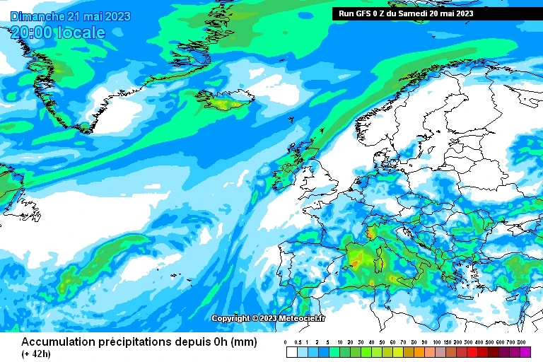
📸 Graphics provided by Meteociel


