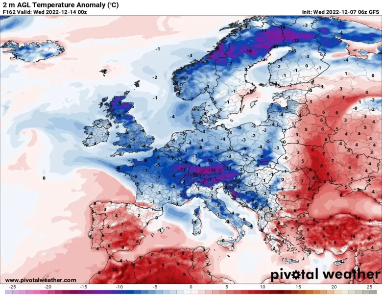
Colder air from the Arctic will spread across northern and central Europe over the next few days and will affect weather in southern Europe and then the Balkans by early next week.
❄️ So we are in for a chilly few days with widespread frosts and snow showers across many European countries.
The air from the Arctic will reach down through the Norwegian Sea and result in widespread frosts and severe frosts in places.
By day, temperatures could stay around or just above freezing over the UK, Benelux, France, Poland and Germany, whereas over Scandinavia and Denmark they will be well below freezing by Thursday morning.
The Met Office has issued a yellow weather warning for parts of Wales, Northern Ireland, England’s east coast, northern Scotland and the western isles.
🌨 This Arctic outbreak will spread across southern Europe starting from Sunday and will expand further east across the Balkan Peninsula by early next week.
From Friday to Sunday, the interaction of the Arctic air mass with some Atlantic lows will produce snow showers at low altitude in the Mediterranean area.
Other lows are forecast for next week and could generate snowfall in the lowlands.
Follow us for the next updates.
📸 Graphics provided by Pivotal Weather


