Chilly air will begin spilling into the eastern U.S. today but the core of the cold arrives over the weekend and lasts through early next week.
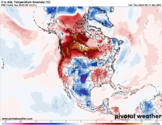
![]() Temperatures 20 degrees below normal, frost and snow are possible in eastern U.S. between Saturday and Monday.Temperatures this weekend into early next week are expected to plummet 10 to 20 degrees below normal over much of the eastern third of the nation.On Sunday and Monday, the Upper Midwest, Great Lakes, Ohio Valley, most of the Mid-Atlantic and Northeast will all endure freezing early morning temperatures.In Washington, these temperatures will probably end the peak bloom of the cherry blossoms.
Temperatures 20 degrees below normal, frost and snow are possible in eastern U.S. between Saturday and Monday.Temperatures this weekend into early next week are expected to plummet 10 to 20 degrees below normal over much of the eastern third of the nation.On Sunday and Monday, the Upper Midwest, Great Lakes, Ohio Valley, most of the Mid-Atlantic and Northeast will all endure freezing early morning temperatures.In Washington, these temperatures will probably end the peak bloom of the cherry blossoms.
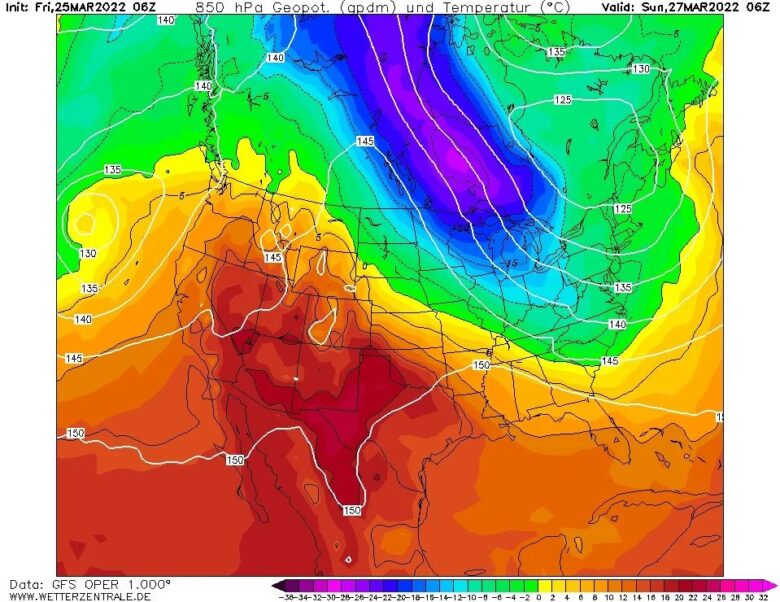
![]() Snow is expected in the higher mountains of the Mid-Atlantic and Northeast as well as downwind of the Great Lakes.Periods of snow are forecast in the central and northern Appalachian Mountains and also enhance lake-effect snow bands downwind of the Great Lakes Friday night and Saturday.As a second disturbance passes through the Northeast on Sunday, some more snow showers are possible downwind of the Great Lakes and on the westward facing slopes (upslope areas) of the Appalachians.
Snow is expected in the higher mountains of the Mid-Atlantic and Northeast as well as downwind of the Great Lakes.Periods of snow are forecast in the central and northern Appalachian Mountains and also enhance lake-effect snow bands downwind of the Great Lakes Friday night and Saturday.As a second disturbance passes through the Northeast on Sunday, some more snow showers are possible downwind of the Great Lakes and on the westward facing slopes (upslope areas) of the Appalachians.
![]() Graphics provided by Wetterzentrale #nextclima#arcticoutbreak#coldspell#coldblast#snow#winterisback#extremeweather#easterncoast#easternus#midwest
Graphics provided by Wetterzentrale #nextclima#arcticoutbreak#coldspell#coldblast#snow#winterisback#extremeweather#easterncoast#easternus#midwest