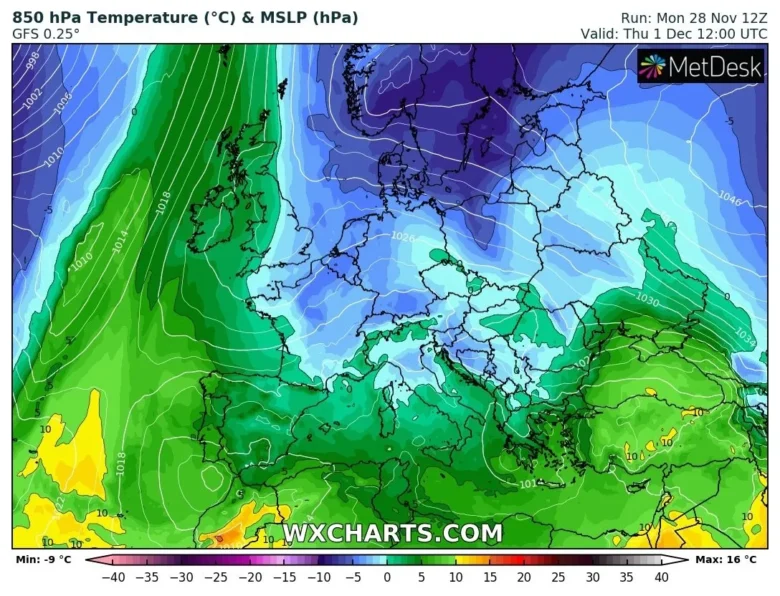
The models this evening are still going for a cooler easterly flow setting up later this week, bringing a period of cooler weather over most of Europe.
❄️ An upper level high pressure will extend over NE Europe and will push away the Atlantic low pressure systems feeding colder air from the east.
A large area of high pressure that’s recently been building over the Urals and western Russia will extend westwards across Scandinavia and far NE Atlantic/Norwegian Sea.
So this will allow a colder continental flow from the east or southeast by the end of this week.
In the meantime, low pressure systems will affect weather over southwestern Europe, bringing unsettled conditions in Portugal, Spain and the Mediterranean area into the start of December.
🌨 A bubble of cold air of a weak trough will move south towards the Mediterranean, where the low-pressure area over the warm water surface may strengthen.
Initially, this seems to bring snow only for Greece and the Balkans, but it is possible that this low-pressure area will still provide a surprise in the Alps later this week.
It looks like the Southeast Alps (Slovenia, Carinthia, Dolomites) will get some snow (10 to 20 centimetres) from the second half of the week with a south-easterly flow.
📸 Graphics provided by Wxcharts.com


