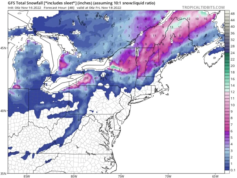
An epic lake-effect snowstorm is expected to bury Buffalo, New York, under up to 3 feet of snow.
⚠️ Lake-effect snow warnings are now in effect east and southeast of lakes Erie and Ontario in western New York, northwest Pennsylvania and far northeast Ohio.
Those warnings include Buffalo and Watertown, New York, and Erie, Pennsylvania.
Major to extreme disruptions are expected in some of the areas under warnings, according to NOAA’s Winter Storm Severity Index.
Snowfall rates of at least an inch per hour could lead to accumulations of 5 to 9 inches between Wednesday night and early Thursday.
There could even be thundersnow within 10 to 15 miles of both lakeshores.
🌨 The lake-effect bands are forecast to shift north and intensify Thursday evening when they will begin to threaten the Buffalo and Watertown metro areas and persist for an extended period of time.
Snowfall rates in this band could exceed two inches per hour and might be accompanied by thundersnow at times.
Travel will be treacherous, if not impossible, at times, along these stretches with whiteout conditions within the heaviest snowbands.
There could even be additional significant accumulations of snowfall to the northeast of both lakes early next week as cold winds continue to blow over the relatively warm waters of lakes Erie and Ontario.
📸 Graphics provided by Tropicaltidbits


