Atlantic low pressures are dominating weather in western Europe until next weekend, making the autumn season start definitively.
🌡By tomorrow a frontal boundary will have pushed right down through France, Spain, the western Mediterranean, the Alps and Germany allowing cooler air over much of western Europe.
By Saturday, this will have swept through Italy and be pestering the Adriatic coast and western Greece.
As a consequence, there will be a temperature drop compared to the values recorded over the last few days, but this will be a return to average or slightly below average temperatures for the period.
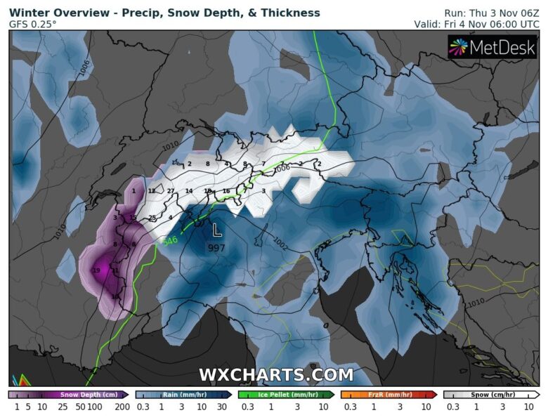
❄️ The Alps are diving into winter for a few days.
A strong cold front combined with a Genoa Low is going to bring a lot of precipitation to the Alps.
On the northern and western sides of the Alps, this will be accompanied by a strong cooling and a rapid drop in the snowline, while in the southern Alps, the southern flow with milder air masses will ensure a higher snowline.
On a large scale, we can expect around 30 to 50 centimetres of snow higher up.
📸 Graphics provided by Wxcharts.com


