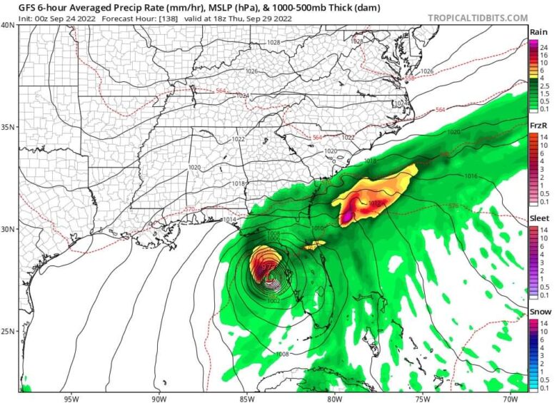
Tropical Storm Ian will track through the Caribbean Sea this weekend and could become a major hurricane threat for Florida and the eastern Gulf of Mexico.
🌀 Rapid intensification is forecast Monday through Wednesday over some very warm water.
Intensity forecasts remain very impressive in the Category 2 – Category 4 range.
Hurricane conditions are possible in the Cayman Islands by early Monday.
The Florida Keys and South Florida can expect heavy rains to begin as early as Monday.
Some flash and urban flooding is possible with this rainfall.
➡️ On the forecast track, the center of Ian is forecast to move across the central Caribbean Sea today, pass southwest of Jamaica on Sunday, and pass near or over the Cayman Islands Sunday night and early Monday.
Ian will then approach western Cuba on Monday.
If it strengthens to a Category 3 or higher before reaching Florida, it would be the first major hurricane to make landfall there since Hurricane Michael in 2018, which was a monster Category 5 storm when it collided with the Florida panhandle.
📸 Graphics provided by Tropicaltidbits and NOAA