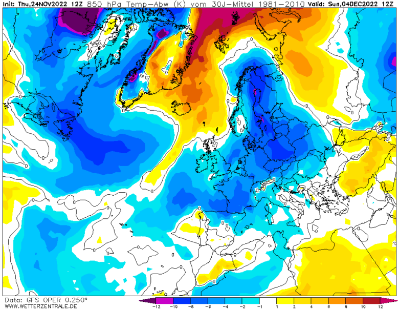
There is potential for a more continental flow from the east to develop over central Europe by early December, so it will likely turn colder, with an increasing risk of frosts in many countries.
➡️ There is signal from extended modelling for blocking high pressure to develop near the UK in early to mid-December.
This would likely bring a halt to the influence of Atlantic lows bringing unsettled conditions through to the end of November and perhaps start of December, to be replaced by drier and more settled conditions, as high pressure builds nearby while the jet stream is split and forced on a more southerly and northerly track around the high pressure, taking low pressure systems more towards southwest Europe and/or over Greenland.
This change from November’s low pressure dominated weather to a more blocked pattern in early December likely related to lag response of the MJO moving into phase 7 and perhaps 8 along with the concurrent +AAM.
➡️ Looking further ahead, the month of January looks to start how December finishes off, with a mobile westerly +NAO regime of low pressure close to the north or northwest and high pressure over the European continent bringing unsettled and often mild conditions.
There is a possibility that December’s high latitude blocking may have put a lot of stress on the stratospheric Polar Vortex which by early January could have been displaced or even split to lead to a SSW.
Confidence is low for this outcome, but higher than normal at this range given the high latitude blocking signal in December.
📸 Graphics provided by Wetterzentrale


