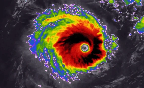
Powerful Tropical Cyclone Freddy, a long-lived storm that was churning westward across the Indian Ocean on Saturday more than a week after forming near Indonesia, is expected to continue taking an unusual track toward Madagascar next week, as the equivalent of a Category 3 or 4 hurricane. 🌀 As of Saturday afternoon, local time, Freddy was …
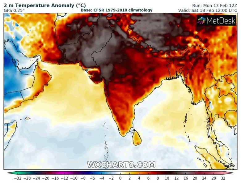
An unprecedented heatwave over Central Asia will intensify over the next few days, breaking other historical records for mid-February. 🚩 Yesterday temperatures reached 38.8°C in India at Karwar, 38.3°C at Ratnagir, 37.9°C at Goa, 38.6°C in NE Thailand at Mukdahan.Sharurah, at 720m asl, in Saudi Arabia jumped to 37.0°C.Also Taiwan recorded astonishing temperatures for February …
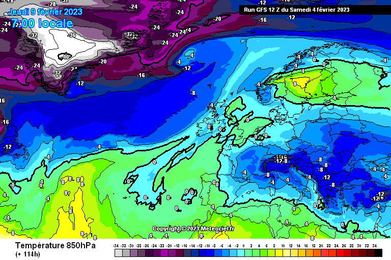
We are on the eve of an intense continental outbreak that will affect much of the European continent next week. ❄️ The areas most affected will be eastern Europe, the Balkans and Italy, but the continental flow from Siberia will push further west around the middle of next week, also marginally affecting Spain and France.At …
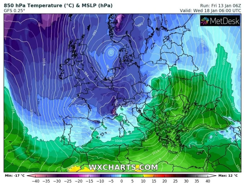
Next week a continental flow of freezing air from Siberia will bring winter weather conditions over most of Europe. ❄️ The continental air mass will spread across eastern and northern Europe over the next weekend and will affect weather also in central and southern Europe for the whole next week.The frigid air from Siberia will …
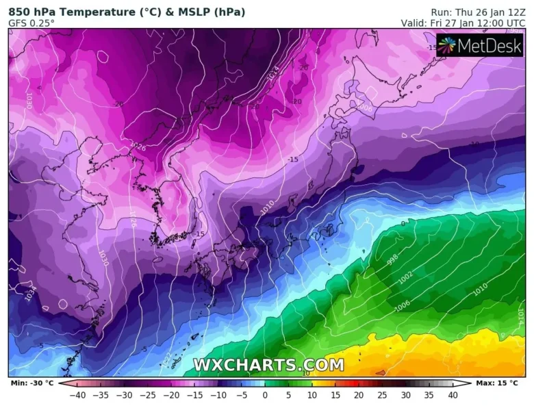
Frigid winter weather gripped East Asia for the third straight day on Thursday, causing several deaths and multiple injuries in Japan and South Korea. 🚩 Record cold temperatures were seen in parts of Japan, with snow falling on the Sea of Japan coast stretching from the country’s north to west.Record lows were logged in several locations, including one …
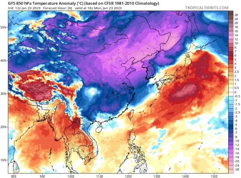
Extreme cold hits China’s Heilongjiang province: yesterday Mohe dropped to -53.0°C (-63.4°F), the lowest temperature in Chinese history. 🚩 The minimum temperature at Jingtao automated weather station in the town of Amur, Mohe City in Heilongjiang Province, China fell to -53.0°C (-63.4°F) on January 22, 2023, marking the lowest temperate ever recorded in the province …
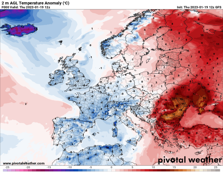
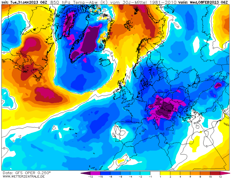
While central and western Europe grappled with an Arctic outbreak that brought widespread frost and snowfall, record warmth was recorded in eastern Europe. 🚩 Yesterday Romania broke its warmest January record with 22.4°C at Turnu Magurele.Bucharest rose to 20.6°, another January record smashed by 3°C.29 weather stations in Romania recorded highs above 19°C, destroying their …
In the next few hours, two winter storms, Gerard and Fien, will bring strong winds, heavy rain and snow over SW Europe: firstly (Tempête) Gerard, named by Meteo France which will deepen in the English Channel on Sunday night and secondly (Borrasca) Fien named by AEMET passing by early on Tuesday. 1️⃣ Storm Gerard is forecast to move west …
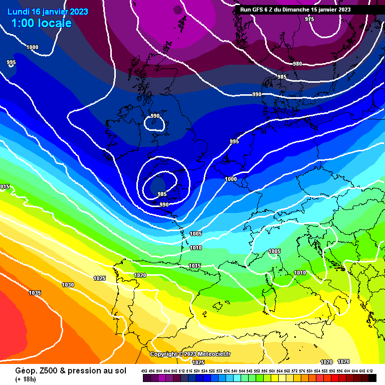
After a mild start to January over most of the European continent, it looks set to turn much colder from early next week, with an increasing risk of snow in places and overnight frost and ice. ❄️ A pattern change is on the way early next week, as the recent zonal west to east jet …
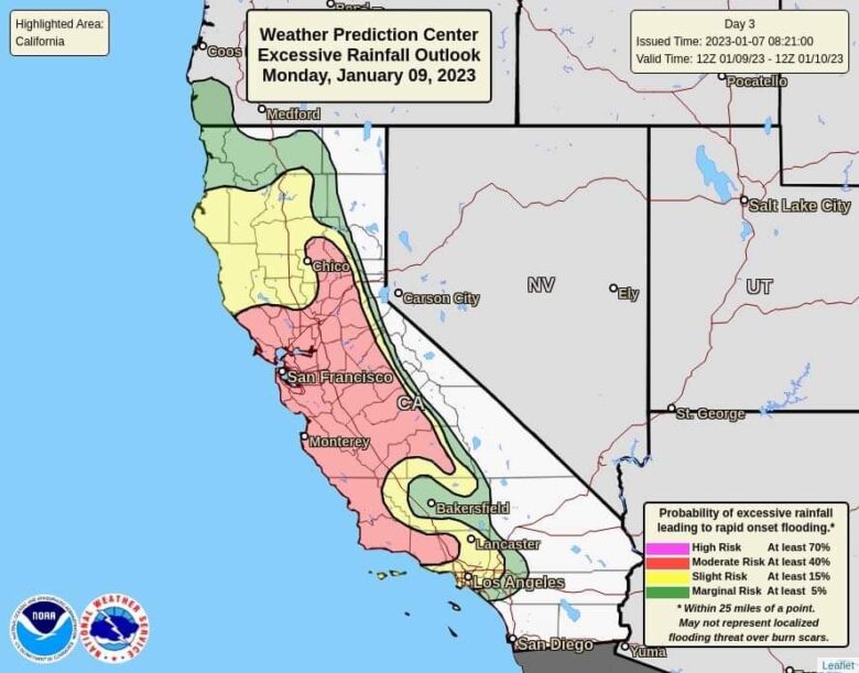
More atmospheric river storms are expected to hit California this week, one week after a deadly bomb cyclone brought heavy rain and flooding to California. 🌧 An atmospheric river arriving Sunday night is causing significant impact to travel and infrastructure due to heavy rain, heavy mountain snow and damaging wind gusts through Tuesday.River flooding, mudslides, power outages, road closures, tree …