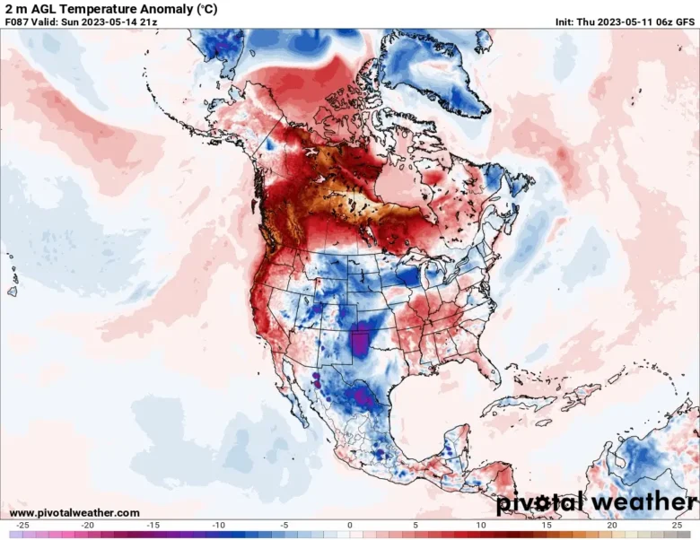
A heat wave that looks like the historic June 2021 event is getting underway in parts of northern Canada and will spread to British Columbia and Alberta, as well as into the northern United States.
🔥 After one of the coolest starts to spring since 2012, an early-season heat wave is possible this weekend for coastal portions of the Pacific Northwest.
A zone of high pressure, also called a heat dome, is set to expand and become very intense into this weekend.
The heat dome’s projected intensity would be near historic values in summer, let alone spring.
The system is starting to gather around the Hudson Bay and will mostly affect a region from the Pacific Northwest to Alberta.
The heat wave is set to reach its peak Friday and last through early next week.
🚩 With temperature departures of 20-30 degrees above average, numerous records may be broken as daily highs approach or exceed 90°F.
While the 2021 event toppled many all-time records in the U.S. Pacific Northwest and Canada, the configuration and powerful nature of this week’s event is similar.
Temperatures are likely to be shy of those extremes because the event is happening earlier in the year than in 2021.
But temperatures reaching or breaking a range of 94 to 104 degrees Fahrenheit are still likely, putting peak temperatures between 18 to 36 degrees above normal.
📸 Graphics provided by Pivotal Weather


