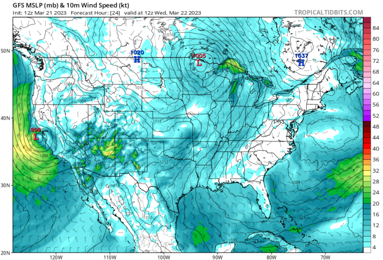
A strong storm will move ashore across California today accompanied by strong winds, heavy rain and heavy snow for the higher terrain.
🌀The storm center is expected to approach and possibly make landfall near San Francisco this evening, bringing potentially damaging wind gusts, especially as the system acquires some sub-tropical characteristics near the center under an anomalously cold upper low over the ocean.
A strong pressure gradient is also anticipated, which could lead to maximum wind gusts near 120 km/h (75 mph) across southern California.
🌨 Moreover, the storm is also expected to bring heavy rain to central coastline and southern California, leading to rapid runoff and areas of flooding.
In the mountainous regions of central and southern California, heavy snowfall is anticipated with accumulations of up to 91 to 122 cm (3 to 4 feet) in some spots.
This could lead to difficult travel conditions and strain infrastructure in areas still recovering from a record-breaking snowpack.
❄️ California is currently experiencing a winter season like no other, as snowpack statewide has exceeded double the normal levels for this time of year.
Despite the overwhelming moisture, the southern Sierra has experienced the most significant benefits of the active winter season.
This season, Soda Springs, California has received 17.2 m (56.4 feet) of snow, marking the second snowiest season since records began in 1946.
📸 Graphics provided by Tropicaltidbits