A powerful winter storm will develop into Scandinavia in the next few days with a wintry mix near the northeastward racing warm front but heavy snow to the east and north ahead of it.
❄ A combination of heavy wintry precipitation, including heavy snow with the strong winds, should also bring blizzard conditions especially across Lapland and central Finland through Wednesday into the night.
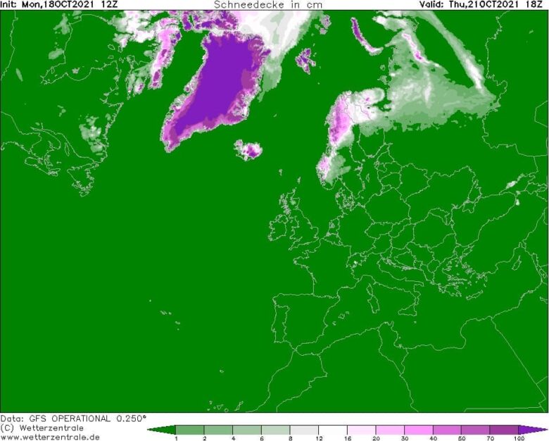
The northern Scandinavia, especially northern Norway, Sweden and Finland are likely to receive more snow this coming week.
🌨 Depending on the position of the surface low, snow amounts could vary a lot as the boundary between warmer and colder air mass will be relatively sharp.
The highest amounts of fresh snow are forecast to the immediate north-northeast of the traveling low, likely across northeast Sweden into the Lapland region of northern Finland.
There, more than 50 cm of new snow could accumulate over the next 5 days.
Quite some snow, locally 50cm+ is also likely across the northern half of Iceland.
🌧 It has to be noted that, as the cold is placed over Scandinavia this weekend, the arrival of much warmer air mass aloft could also develop dangerous conditions for freezing rain and sleet in some areas.
The position of the low indeed plays a huge role here in how the air masses will clash together, resulting in heavy winter precipitation in some places while others remain under the warmth and heavy rain to the south.
📸 Graphics provided by Wetterzentrale
#nextclima #winterstorm #snowfall #snow #snowstorm #freezingrain #sleet #scandinavia #norway #finland #swedem #iceland #lapland #extremeweather #severeweather


