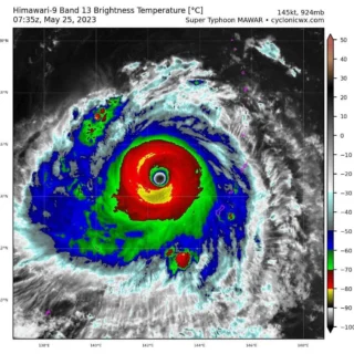
Super typhoon Chanthu (locally called Kiko) has rapidly intensified from tropical depression to Category 5 typhoon within 24 hours with maximum wind speeds of 260 km/h.
![]() Chanthu reached a Category 5 super typhoon status at 09:00 UTC on September 8, 2021, becoming the second super typhoon of the year.In the Philippines, this tropical cyclone is known as Kiko. Super typhoon Chanthu is forecast to strike the Philippines as a typhoon at about 06:00 GMT on 10 September. Chanthu is about 1,120 km east of Central Luzon and based on the storm’s speed and path, it will come the closest to Taiwan on Saturday and Sunday. The Central Weather Bureau will likely issue sea warning sometimes between Thursday and Friday.
Chanthu reached a Category 5 super typhoon status at 09:00 UTC on September 8, 2021, becoming the second super typhoon of the year.In the Philippines, this tropical cyclone is known as Kiko. Super typhoon Chanthu is forecast to strike the Philippines as a typhoon at about 06:00 GMT on 10 September. Chanthu is about 1,120 km east of Central Luzon and based on the storm’s speed and path, it will come the closest to Taiwan on Saturday and Sunday. The Central Weather Bureau will likely issue sea warning sometimes between Thursday and Friday.
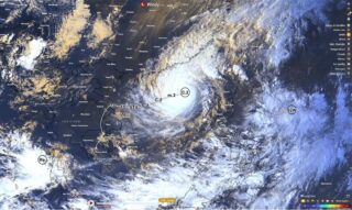
![]() While there is no Tropical Cyclone Wind Signal currently in effect in the Philippines, PAGASA warns heavy rains associated with the typhoon may begin affecting the eastern section of Northern Luzon on Friday. The public and disaster managers in these areas are advised to continue monitoring for updates and take appropriate preparatory activities. Due to favorable environmental conditions, the typhoon is expected to continuously intensify until Saturday, when it is likely to reach its peak intensity of 185 to 205 km/h (115 – 130 mph), while moving over Northern Luzon. Weakening is possible on Sunday as it moves closer to Taiwan and interacts with its rugged terrain.
While there is no Tropical Cyclone Wind Signal currently in effect in the Philippines, PAGASA warns heavy rains associated with the typhoon may begin affecting the eastern section of Northern Luzon on Friday. The public and disaster managers in these areas are advised to continue monitoring for updates and take appropriate preparatory activities. Due to favorable environmental conditions, the typhoon is expected to continuously intensify until Saturday, when it is likely to reach its peak intensity of 185 to 205 km/h (115 – 130 mph), while moving over Northern Luzon. Weakening is possible on Sunday as it moves closer to Taiwan and interacts with its rugged terrain.
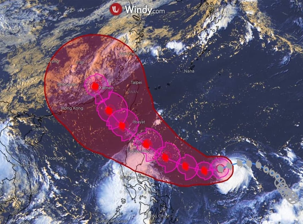
![]() Credits: Windy and PAGASA
Credits: Windy and PAGASA
#nextclima#typhoon#typhoonkiko#typhoonchanthu#supertyphoon#kiko#chanthu#tropicalcyclone#luzon#china#taiwan#philippines#philippinessea#extremeweather#severeweather