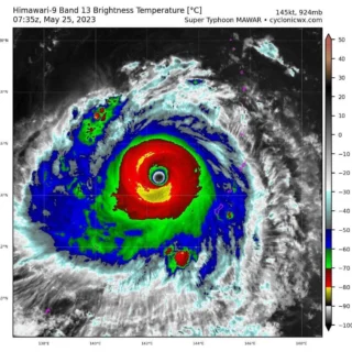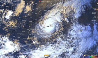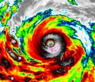
Super Typhoon Noru, known locally as Super Typhoon Karding, reintensified after exiting the Philippines and entering the warm waters of the East China Sea and will approach Vietnam in the next few hours.
🌀 At 06:00 UTC on September 27, its center was located about 950 km (590 miles) west of Manila, Philippines.
The minimum central barometric pressure was 950 hPa, and the system was moving west toward central Vietnam at 15 km/h (9.2 mph).
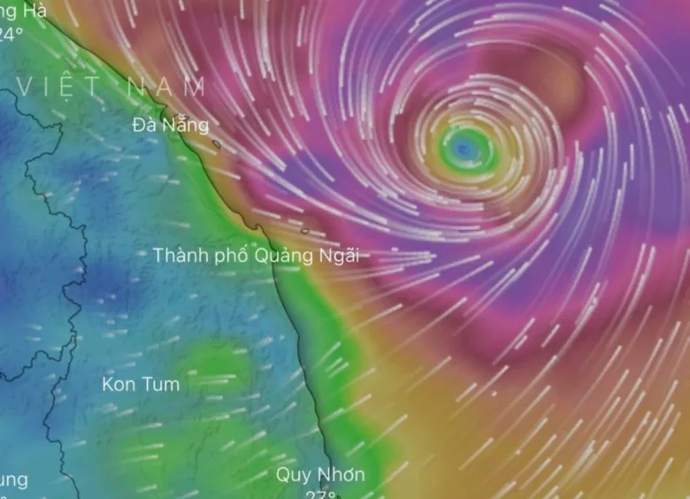
Noru is still anticipated to be a very strong typhoon when it crosses the coast in the vicinity of Da Nang, Vietnam around 03:00 UTC on September 28.
Noru will be one of the most powerful storms to hit the country in 20 years.
☔️ Noru is expected to drop up to 400 mm (16 inches) in central and Central Highlands regions from Tuesday afternoon (LT) to Wednesday.
Between 250 and 400 mm (100–16 inches) of rainfall is expected in Da Nang and the provinces of Quang Tri, Thua Thien-Hue, Quang Nam, Quang Ngai, and Kon Tum; 100 to 300 mm (4–12 inches) in Quang Binh, Binh Dinh, and Gia Lai.
From Wednesday to Friday, the rainfall is expected to expand towards the northern parts of the central region; as well as the southern parts of the northern region.
📸 Graphics provided by Windy, JWTC and PAGASA