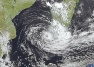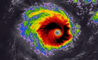
A tropical storm Wanda is soon on the way towards Europe, the second system of the Atlantic Hurricane Season that has come so far east in the Basin, closing in the European continent (the other system was major hurricane Sam which impacted Iceland in early October).
![]() After its transition into an extratropical low on Sunday (night) while passing just to the north of the Azores, Wanda will accelerate northeast.The earliest reasonable time it reaches western Europe would be late Monday.Wanda or its remnants will turn towards the UK and Ireland on Monday, bringing rain and strong to severe winds with cold weather as conditions become unsettled over the next few days.The remnants are possible to affect the west of Ireland and Scotland.
After its transition into an extratropical low on Sunday (night) while passing just to the north of the Azores, Wanda will accelerate northeast.The earliest reasonable time it reaches western Europe would be late Monday.Wanda or its remnants will turn towards the UK and Ireland on Monday, bringing rain and strong to severe winds with cold weather as conditions become unsettled over the next few days.The remnants are possible to affect the west of Ireland and Scotland.
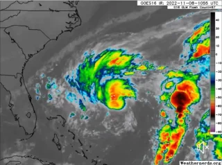
![]() While Wanda may bring wind and rain to the western half of Ireland, the much more intense North Atlantic low is seen farther north.The system will have deep central pressure and powerful winds, thankfully staying over the open waters of the Atlantic.Also, the Met Eireann has noted that the remnants of Wanda are, despite tracking close to Ireland early next week, unlikely to cause many issues for the country.
While Wanda may bring wind and rain to the western half of Ireland, the much more intense North Atlantic low is seen farther north.The system will have deep central pressure and powerful winds, thankfully staying over the open waters of the Atlantic.Also, the Met Eireann has noted that the remnants of Wanda are, despite tracking close to Ireland early next week, unlikely to cause many issues for the country.
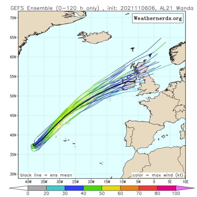
![]() Graphics provided by Windy and Weathernerds.com#nextclima#wanda#tropicalstormwanda#tropicalstorm#ireland#scotland#uk#northatlantic#atlanticocean#atlantic#azores
Graphics provided by Windy and Weathernerds.com#nextclima#wanda#tropicalstormwanda#tropicalstorm#ireland#scotland#uk#northatlantic#atlanticocean#atlantic#azores