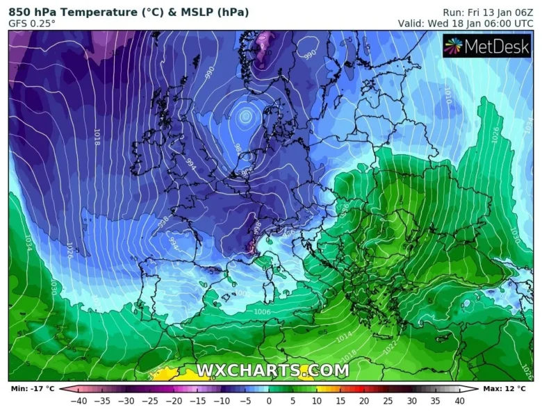
After a mild start to January over most of the European continent, it looks set to turn much colder from early next week, with an increasing risk of snow in places and overnight frost and ice.
❄️ A pattern change is on the way early next week, as the recent zonal west to east jet stream buckles north upstream over the North Atlantic and orientates to flow more northwest to southeast.
The models show a very active and developmental pattern across NW Europe, with a deep cold polar trough sinking south into Europe, a main area of low pressure to the east and a strong northwesterly jet streak on its western flank forecast to plough southeast over the far north Atlantic towards the west of the UK and on into France and Spain.
This will pull in colder polar air from Greenland and arctic northern Canada.
🌨 The air will become cold enough to support sleet and snow showers to lower levels across many countries on Monday and Tuesday initially, but increasingly colder air flowing in from the northwest and north across all parts will mean snow will fall to lower levels across many locations around mid-next week.
There will also be a widespread risk of frost and ice overnight, where skies clear, as temperatures fall below freezing
The cold conditions will last most the week.
📸 Graphics provided by Wxcharts.com


