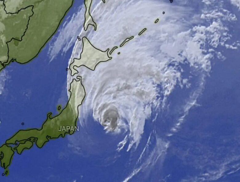
Typhoon Mindulle is passing near Japan’s coast. ![]() Typhoon Mindulle Category 1 is still a strong storm with maximum sustainable winds of 120 km/h.It is currently moving north-northeast approximately 290km east of Chōshi. Mindulle is travelling at speed of around 40 kilometers per hour and it is expected to weaken into an extratropical depression east of Japan by Saturday evening.The storm’s track and intensity forecast remain somewhat uncertain and the system may change accordingly over the coming days.
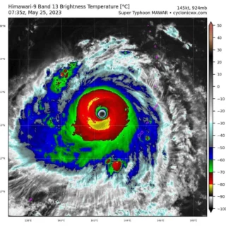
Typhoon Mindulle Category 1 is still a strong storm with maximum sustainable winds of 120 km/h.It is currently moving north-northeast approximately 290km east of Chōshi. Mindulle is travelling at speed of around 40 kilometers per hour and it is expected to weaken into an extratropical depression east of Japan by Saturday evening.The storm’s track and intensity forecast remain somewhat uncertain and the system may change accordingly over the coming days.![]() The storm is bringing heavy rain and strong gusts to Japan’s Pacific coastAir and train services are disrupted, over 100 flights has been cancelled. Sustained heavy rainfall could trigger flooding in low-lying communities near streams, creeks, rivers, and urban areas with inadequate stormwater drainage systems.Flooding could isolate some communities for several days. Forecast models indicate that heavy rain of up to 12 cm (5 inches) is likely over the Izu Islands and the Kanto Region, while up to 8 cm (3 inches) of rainfall is forecast over the Tohoku Region through early Oct. 2.<
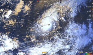
The storm is bringing heavy rain and strong gusts to Japan’s Pacific coastAir and train services are disrupted, over 100 flights has been cancelled. Sustained heavy rainfall could trigger flooding in low-lying communities near streams, creeks, rivers, and urban areas with inadequate stormwater drainage systems.Flooding could isolate some communities for several days. Forecast models indicate that heavy rain of up to 12 cm (5 inches) is likely over the Izu Islands and the Kanto Region, while up to 8 cm (3 inches) of rainfall is forecast over the Tohoku Region through early Oct. 2.<![]() Prolonged swells and storm surge generated by the system will likely result in coastal flooding as the system approaches land.Persistent onshore flow could make it difficult for the surge to recede and for water levels to decrease in coastal river catchments.Wave heights of up to 11 m (36 feet) are forecast over the Izu Islands while waves of up to 9 m (30 feet) are likely over the Kanto Region through Oct. 2.
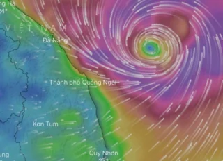
Prolonged swells and storm surge generated by the system will likely result in coastal flooding as the system approaches land.Persistent onshore flow could make it difficult for the surge to recede and for water levels to decrease in coastal river catchments.Wave heights of up to 11 m (36 feet) are forecast over the Izu Islands while waves of up to 9 m (30 feet) are likely over the Kanto Region through Oct. 2.![]() Graphics provided by Windy and PAGASA
Graphics provided by Windy and PAGASA
#nextclima#typhoon#typhoonmindulle#cyclonemindulle#mindulle#japan#kanto#tohoku#chosi#izuislands#pacificocean#stormsurge#majorwaves#flooding#flashflooding#severeweather#extremeweather
Typhoon Mindulle passing near Japan’s coast