Violent Storm Barra is blasting into Ireland and UK with severe damaging winds.
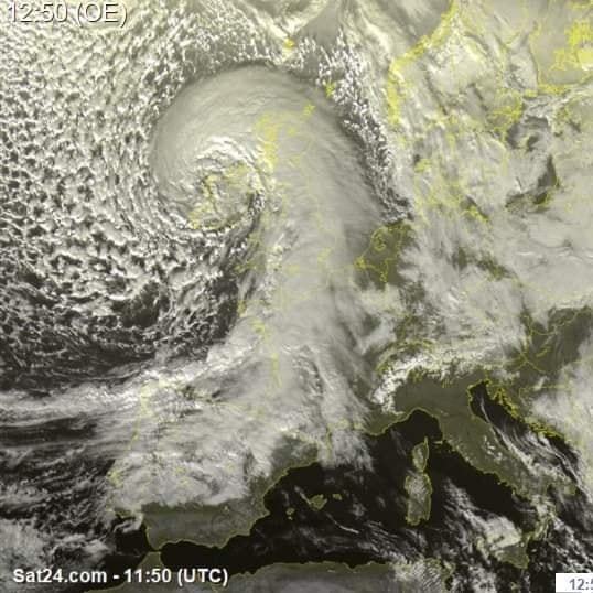
![]() Winds are intense, locally damaging with potentially even hurricane-force speeds along the western-southwestern coast of Ireland.From the satellite it’s clear that Barra is now entering a bomb cyclone phase. A deep low is classified as a bomb cyclone when a system is intensifying very rapidly.Bomb cyclones form when explosive cyclogenesis (also known as bombogenesis) with the rapid deepening of its barometric pressure occurs. The surface pressure is now dropping rapidly.That will be a result of nearly 45-50 mbar change in about 24-30 hours, so an extremely rapid pressure drop to say at least.More than enough for a bombogenesis classification.
Winds are intense, locally damaging with potentially even hurricane-force speeds along the western-southwestern coast of Ireland.From the satellite it’s clear that Barra is now entering a bomb cyclone phase. A deep low is classified as a bomb cyclone when a system is intensifying very rapidly.Bomb cyclones form when explosive cyclogenesis (also known as bombogenesis) with the rapid deepening of its barometric pressure occurs. The surface pressure is now dropping rapidly.That will be a result of nearly 45-50 mbar change in about 24-30 hours, so an extremely rapid pressure drop to say at least.More than enough for a bombogenesis classification.
![]() Once the center of Barra goes ashore to Ireland, the main front squalls will be blasting across Wales and southwestern England.North Atlantic storm Barra will also bring quite a lot of rain into western Europe, especially across Ireland and the western UK, Scotland, including Wales. Some areas are about to receive up to about 80-120 mm of rain through Wednesday evening and rivers could lead to flooding.Destructive waves with heights up to 40+ feet are possible as well.
Once the center of Barra goes ashore to Ireland, the main front squalls will be blasting across Wales and southwestern England.North Atlantic storm Barra will also bring quite a lot of rain into western Europe, especially across Ireland and the western UK, Scotland, including Wales. Some areas are about to receive up to about 80-120 mm of rain through Wednesday evening and rivers could lead to flooding.Destructive waves with heights up to 40+ feet are possible as well.
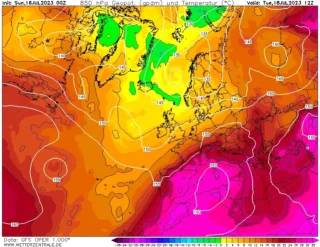
![]() The southern part of Barra will also lead to a secondary low forming towards central Europe and the northern Mediterranean that will develop another winter storm with fresh deep snowpack for the region.This will give up to half a metre of snow, more to come on Friday.Also the Southern Alps and some locations across northern Italy are going to get a lot of fresh snow.This has everything to do with the depression over the Mediterranean Sea and a strong southerly flow that blows a lot of moist air on the Southern Alps and North of Italy.
The southern part of Barra will also lead to a secondary low forming towards central Europe and the northern Mediterranean that will develop another winter storm with fresh deep snowpack for the region.This will give up to half a metre of snow, more to come on Friday.Also the Southern Alps and some locations across northern Italy are going to get a lot of fresh snow.This has everything to do with the depression over the Mediterranean Sea and a strong southerly flow that blows a lot of moist air on the Southern Alps and North of Italy.
![]() Graphics provided by Sat24 and Meteociel#nextclima#barra#stormbarra#storm#atlanticstorm#bombcyclone#northatlantic#ireland#uk#england#wales#scotland#mediterranean#alps#italy#france#winterstorm#snow#snowfall#severeweather#extremeweather
Graphics provided by Sat24 and Meteociel#nextclima#barra#stormbarra#storm#atlanticstorm#bombcyclone#northatlantic#ireland#uk#england#wales#scotland#mediterranean#alps#italy#france#winterstorm#snow#snowfall#severeweather#extremeweather