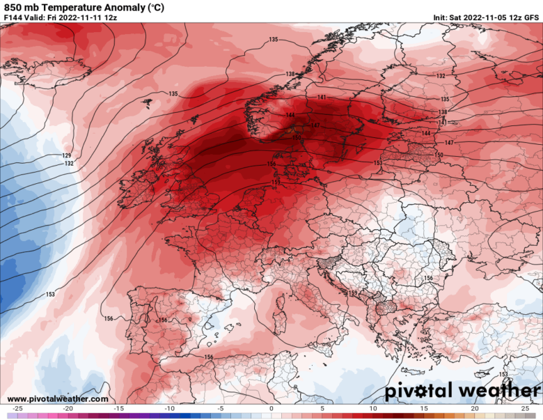
Much warmer weather will advect into most of continental Europe next week, as predicted by our Onda model.
🌡 Temperatures will again be well-above average, potentially even more than 10°C warmer than normal in some locations.
A strong cyclonic circulation will bring a lot of warm air mass across continental Europe, gradually spreading across most of Europe in the mid to late-next week.
A strong Atlantic storm will bring severe winds and major waves to Ireland and the UK, while high-pressure and blocking high will develop and strengthen over central Europe.
There is no significant cold outbreak foreseen in the mid-term period.
It is more likely that very warm weather will extend into mid-November.
➡️ But a big change is forecast starting from the second part of the month, when some negative temperature anomalies are expected across northwestern and then central Europe.
This time the UK, France, Benelux, Germany, Italy and other countries in central Europe may experience cooler than average temperatures.
The last two weeks of November should be more dynamic with frequent cold fronts spreading across much of Europe, while December seems to be more stable, due to the strengthening of the Polar Vortex.
📸 Graphics provided by Pivotal Weather


