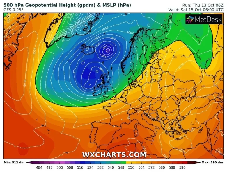
While next week most of the European continent will be under the influence of a strong upper-level ridge with potentially record-breaking highs, an intense and wide trough is expected in the North Atlantic and will affect weather in England, UK and western Europe.
🌀 A waving front will skirt along northern France and might trouble the Channel Islands during Friday and overnight into Saturday.
This cyclone will bring strong winds to the Northern Isles on Friday and gusty winds will strengthen again near the trough line heading over Northern Ireland and western Scotland during Friday night.
This will bring a bout of rain and wind across the Irish Sea and the rest of Scotland before dawn on Saturday.
Other trough lines move across Britain during the day. So, there will be spells of bright, even sunny weather before the skies darken and heavy blustery rain sets in.
🌬 As another low moves towards Ireland later on Saturday, strong winds will affect Northern Ireland, with gales through the Irish Sea with a very windy start for northern England, particularly over Pennine routes early Sunday.
These high winds continue over a central swathe of Britain through Sunday with lee gusts and could bring disruption to travel.
Locally, peak gusts will be around 80-100 km/h, while the most affected land areas will be south and southwest Ireland.
By the middle of next week, severe winds are forecast also in the coastal areas of western Europe due to a large trough slowly moving south-eastwards that will bring some rainfall over Ireland, England, Portugal, Spain, France and Benelux.
📸 Graphics provided by Wxcharts.com


