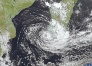
Tropical Storm Roslyn strengthens off Mexico’s Pacific coast and is expected to be a strong Category 2 hurricane before curving northward and reaching the coast Saturday night or Sunday.
🌀 At 7.00 AM CDT (12.00 UTC), the center of Tropical Storm Roslyn was located about 190 miles (305 km) south of Manzanillo, Mexico.
On the forecast track, the center of Roslyn will move parallel to the southwestern coast of Mexico today and tonight, then approach the coast of west-central Mexico, making landfall along this coastline between Saturday night and Sunday.
🌬 Maximum sustained winds are near 65 mph (100 km/h) with higher gusts.
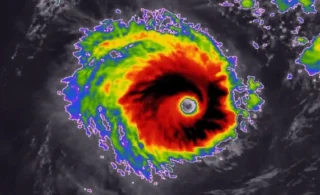
Rapid strengthening is expected during the next day or so and Roslyn is forecast to become a hurricane later today. Roslyn is expected to still be a hurricane when it reaches the coast of west-central Mexico on Sunday.
Hurricane conditions are expected to reach the coast within the hurricane warning area by late Saturday.
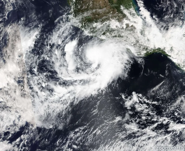
🌊 A dangerous storm surge is expected to produce significant coastal flooding near and to the east of where the center makes landfall.
Near the coast, the surge will be
accompanied by large and destructive waves.
Swells generated by Roslyn are affecting portions of the coast of southwestern Mexico and will spread northward to the coast of west-central Mexico and the southern portion of the Baja California peninsula through the weekend.
📸 Graphics provided by ZoomEarth and NOAA