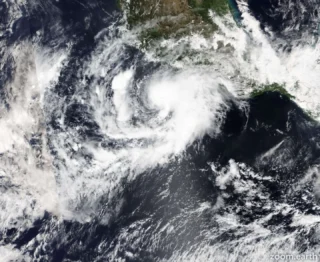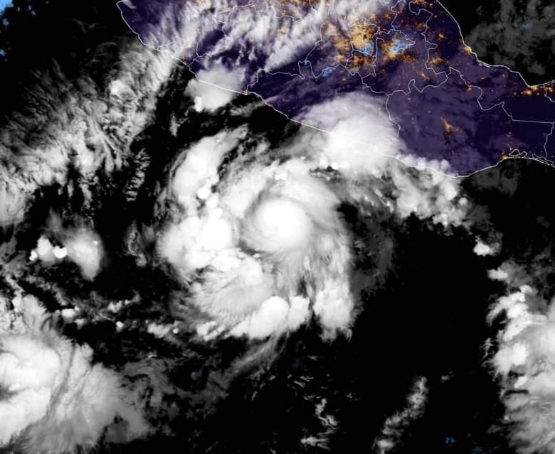
Mexico’s southwestern Pacific coast will need to remain on high alert through the weekend as newly formed Hurricane Rick has churned up in the warm tropical waters of the eastern Pacific Ocean.
🌀 A Hurricane Watch is in effect for Tecpan de Galeana to Punta San Telmo.
Hurricane conditions are possible there by late Sunday, with tropical storm conditions possible by Sunday afternoon.
A Tropical Storm Watch is in effect for east of Tecpan de Galeana to Acapulco, and west of Punta San Telmo to Manzanillo.
Tropical storm conditions are possible there by Sunday afternoon.
A Hurricane Warning and a Tropical Storm Warning will likely be required for portions of the coast of Mexico later today.
🌬 Satellite images indicate that the maximum sustained winds have increased to near 75 mph (120 km/h) with higher gusts.
Hurricane-force winds extend outward up to 15 miles (30 km) from the center and tropical-storm-force winds extend outward up to 60 miles (95 km) from the center.
The estimated minimum central pressure is 990 mb (29.23 inches).
Rapid strengthening is forecast to take place during the next day or so, and Rick is expected to become a major hurricane on Sunday.
🌊 A storm surge is expected to produce significant coastal flooding in areas of onshore winds near and to the east of where the center of Rick makes landfall in southwestern Mexico.
Near the coast, the surge will be accompanied by large and destructive waves.
Rick is expected to produce 5 to 10 inches of rain with isolated storm total amounts of 15 inches across coastal sections of the Mexican states of Guerrero and Michoacan from tonight through Tuesday. This heavy rainfall will likely produce flash flooding and mudslides.
📸 Credits: AccuWeather and NOAA
#nextclima #hurricanerick #rick #hurricane #mexico #pacificocean #guerrero #michoacan #tecpandegaleana #acapulco #puntasantelmo #manzanillo #stormsurge #rainfall #extremeweather #severeweather