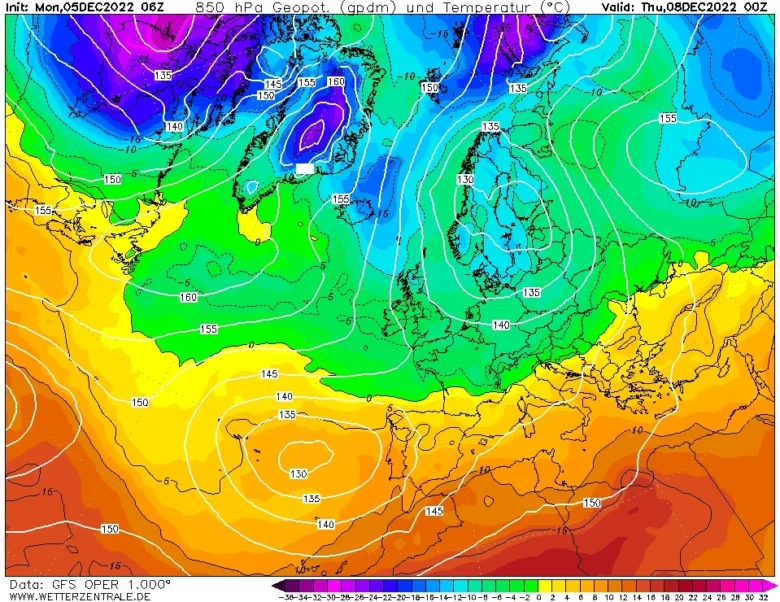
A chunk of the tropospheric polar vortex will push out from the arctic southwards over Scandinavia and the Norwegian Sea before moving across the UK, Denmark, Benelux, France and Germany later this week.
❄️ At the same time a blocking area of high pressure is building north across Greenland.
So winds will turn northerly by mid-week and will introduce colder air from the arctic across these countries through the second half of the week.
With the the colder air will be an increasing risk of snow.
Southern Europe will be affected at a later stage, from the next weekend and above all from early next week.
🌨 The northerly flow developing across the north later on Tuesday will introduce snow showers across Scotland on Wednesday, more particularly around coasts and most frequent towards the far north.
A Met Office Yellow warning has been issued for northern Scotland.
The airmass will be colder than the easterly last weekend, 15z UKV progs 850 hPa temperatures (around 1500m up) of -6° to -8°C generally on Thursday, but across northern Scotland they get as low as -10°C for a time early on Thursday.


