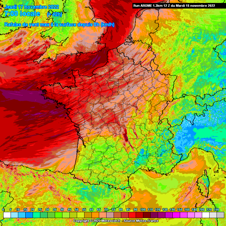
There’s the potential for very wet and windy conditions across southern England Wednesday night, though for now, strongest winds with 70-80mph (110-130km/h) gusts, look to only affect Channel Islands and northern France.
⚠️ The Met Office have issued yellow warning for rain along southern counties of England east of Dorset and in force between 5pm Wednesday to 6am on Thursday.
Flood alerts are beginning to rise again across southern England, given the saturated ground from the wet start to the month, with the additional heavy rain perhaps triggering some flood warnings too over the next few days.
Weather Models today have trended towards running a low further south and a bit shallower across southern England Wednesday night, compared to previous few days runs, which deepened the low more rapidly and deeper, sending the low northeast across Wales and northern England and bringing 70-80mph gusts in the southwest.
But today, models have increasingly tracked the low further and further south, on the 12z runs moving northeast across southern England and on across the Midlands and exiting east coast of England.
🌬 Also, the tightening pressure gradient on the southern side of the low moving northeast brings the risk of gales or severe gales through the English Channel and along the south coasts.
00z ECMWF showed 70-80mph gusts through the Channel, including the Channel Islands, perhaps 50-60mph gusts along the mainland south coast and a little inland, 30-40mph inland across southern most counties.
The 12z model runs appear to have shifted the swathe of severe gales further south still, with Channel Islands and the coast of northern France seeing the highest gusts.
So, for now, it looks like mainland southern England will be spared severe gales, though Channel Islands could see 70-80mph gusts early Thursday, along with the northwest coasts of France.
There were a notable number of ensembles that showed deeper solutions this morning bringing the strongest winds over 60mph across the far SE of England.
📸 Graphics provided by Meteociel


