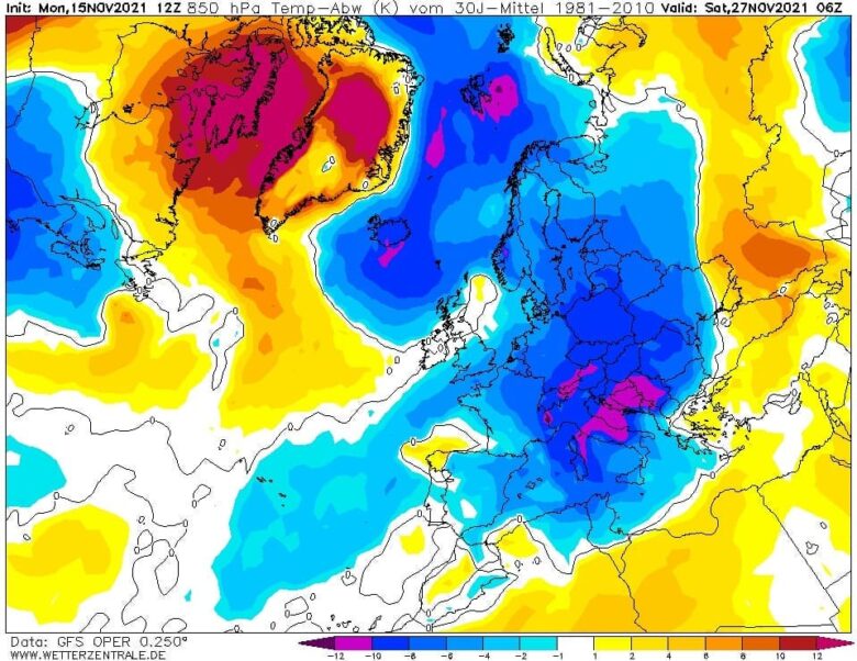
The cold blast over eastern and central Europe reaches its peak today, being the most intense across eastern and southeastern Europe, especially across Ukraine. Nearing about 15°C is below normal for this time of the year. Daytime temperatures will remain much below freezing these days.The rest of Europe remains relatively mild, with the warmest air …
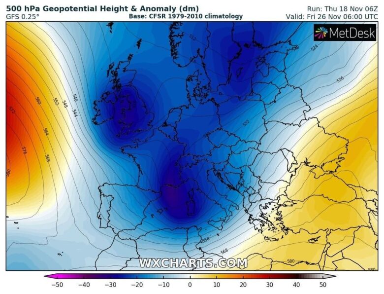
Extreme cold in northern Europe with -29.0°C in Utsjoki Kevo Kevojärvi (Finland) last night, the lowest temperature recorded in the whole mainland Europe so far this winter season. The first Arctic outbreak is expected across central and southern Europe in the next few days and will reach the maximum intensity during the last days of …
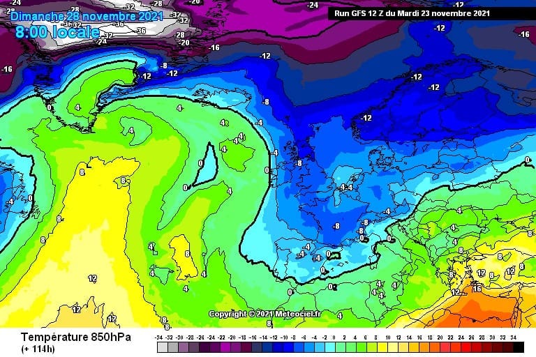
Winter is coming – an intense Arctic blast will spread across much of Europe in the last days of November. Due to a wide high pressure system, many cities of central and southern Europe are now covered by a lid, also called as inversion, which brings unfavorable scattering conditions and leading to a higher concentrations …
Much of Europe will enter a much cooler period in the last week of November due to the first Arctic blast of the winter season. Starting from the next weekend an intense Arctic outbreak is expected across central and then southern Europe.This time also Italy and the Balkans may experience cooler than average temperatures.It will …
After a long period of high pressure in October, November starts off with some amazing weather charts, since much of Europe will enter a much cooler and more changeable phase starting tomorrow. In the next few days the first Arctic blast of the season will spread across northern and then central Europe.Maximum temperatures won’t exceed …
A powerful winter storm will develop into Scandinavia in the next few days with a wintry mix near the northeastward racing warm front but heavy snow to the east and north ahead of it. ❄ A combination of heavy wintry precipitation, including heavy snow with the strong winds, should also bring blizzard conditions especially across Lapland …
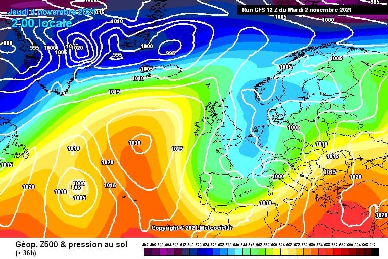
Stable and warm weather is expected under the large High in central Europe and the Balkans, pushing the daytime temperature even into the low 20s in some areas in the next few days. Over the North Atlantic a large cyclone has developed this weekend and will be the trigger for a significant change over Europe.It …
A new surface low establishing in the Mediterranean late this week should bring more storms and rain to the southern Balkan Peninsula. The general pattern will bring a lot of rain and further increase the flooding potential across the southern Balkans.Especially around Greece where a combination of warm advection and the frontal system should bring …
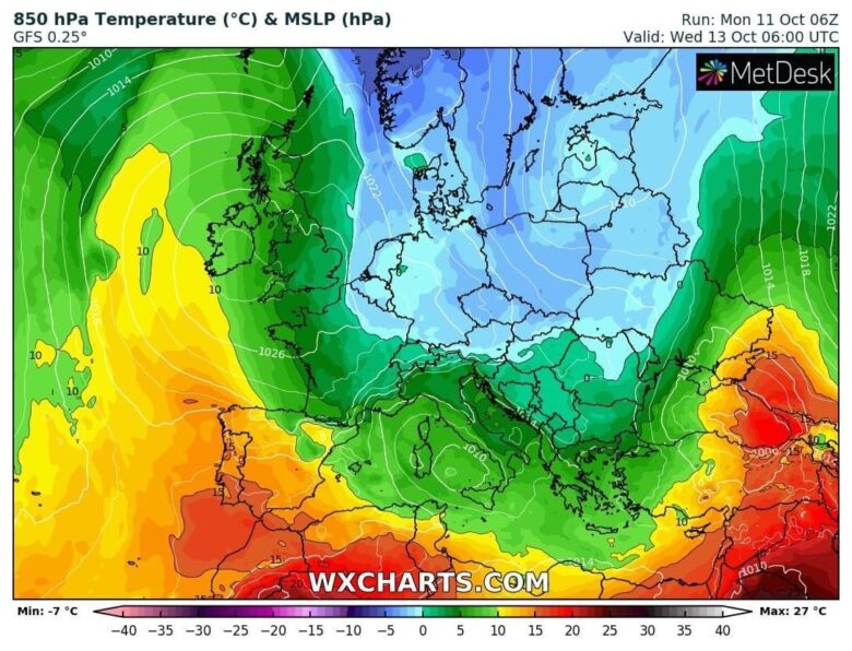
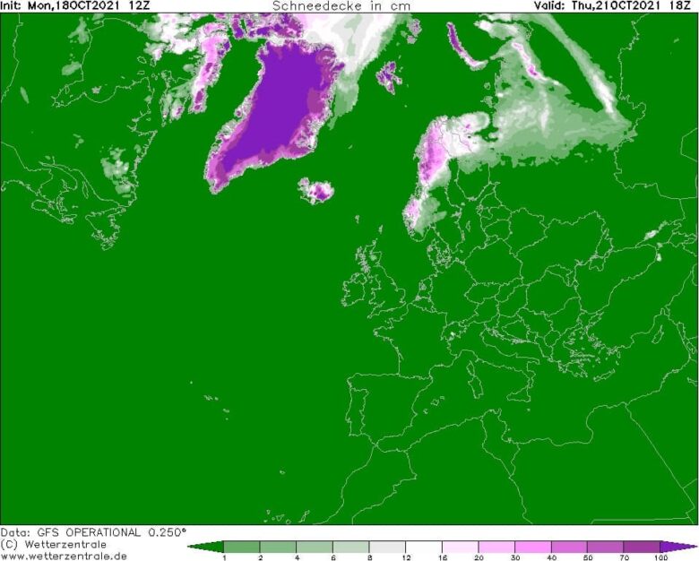
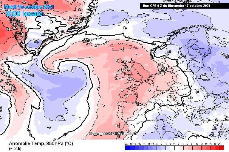
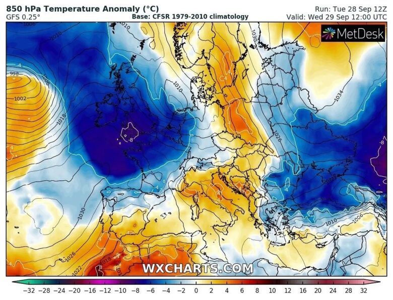
A large part of the European continent should see much below normal temperatures this week again, while western Europe and part of the western Iberian peninsula should see warmer weather in the coming days. Temperatures are forecast to be even more than 10°C colder than normal for mid-October across central Europe first, then also expanding …
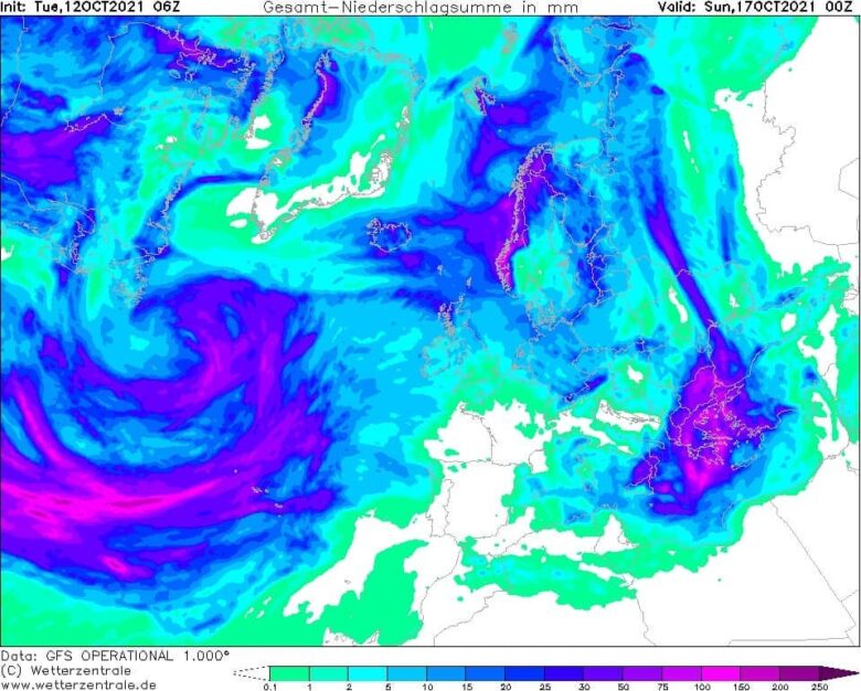
A deep North Atlantic depression will keep maintaining the first autumnal cold advection towards western Europe. Unsettled rainy and windy conditions should be expected in the next few days.Peak wind gusts are likely to be extremely intense in the Denmark Strait, the narrow part of the Atlantic between Iceland and Greenland.Thanks to the very strong …